3D reality capture
Point-cloud and textured-mesh models of real sites — for digital twins, BIM coordination, visualization, and design.
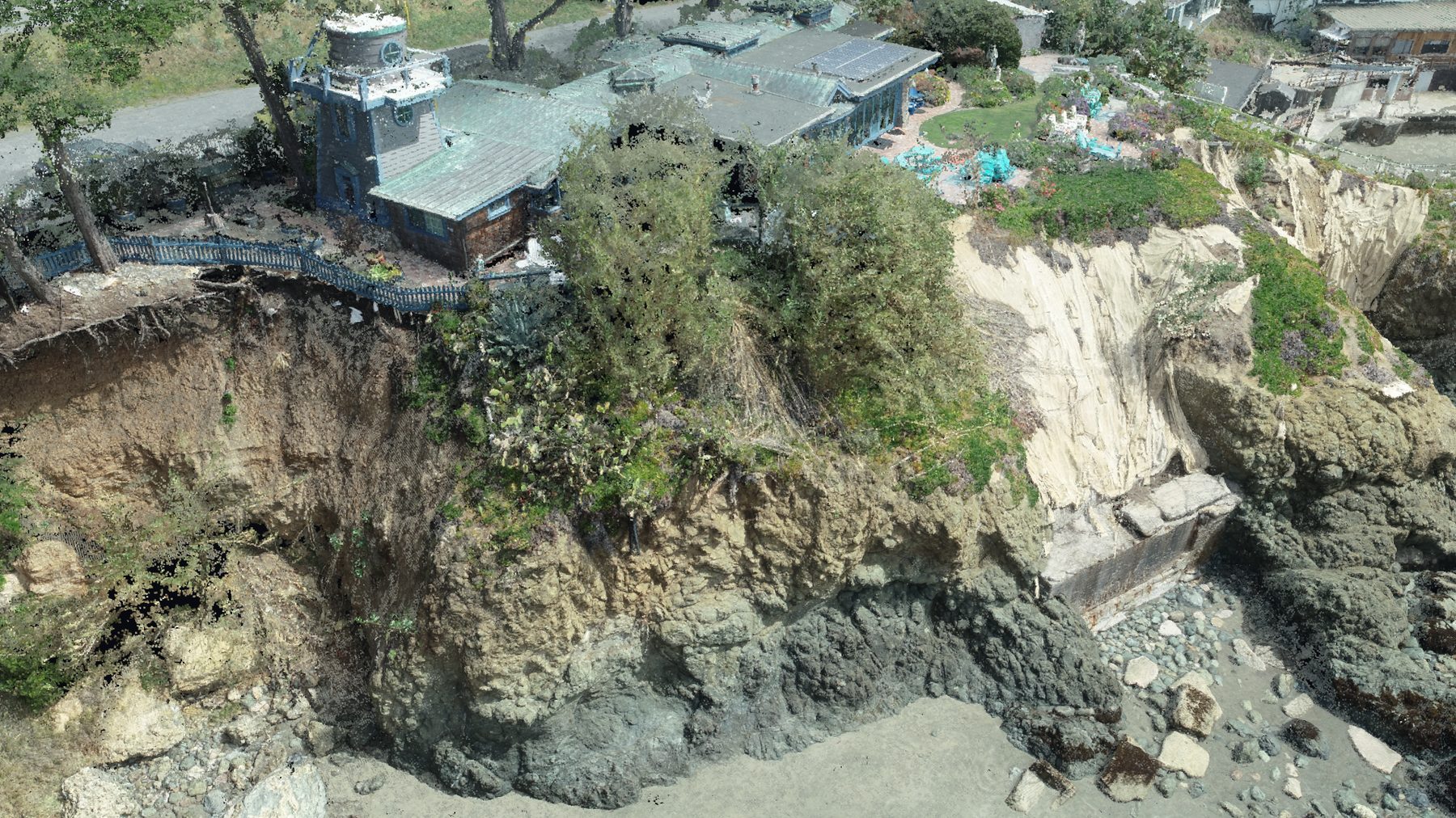
Explore a 3D capture in your browser
Drag to orbit, scroll to zoom — no plugins, right on the page. This is a sample scene; a real CCAM cliff capture drops in here.
Interactive 3D isn’t available on this device — here’s a still preview.
The real world, as a model you can work with
We turn aerial capture into accurate, measurable 3D — colorized point clouds and reality meshes you can inspect, present, and design against. It’s existing conditions captured faithfully, not an artist’s rendering.
- Reality meshes & colorized point clouds
- Measurable, georeferenced, true-to-site
- Inputs for BIM and digital-twin workflows
Put reality data to work
Digital twins
An accurate 3D record of a site or structure as it actually exists today.
BIM coordination
Existing-conditions reality data to design and coordinate against.
Visualization & stakeholder buy-in
Photoreal 3D and flythroughs that make a site legible to anyone.
Measurement & documentation
Measure distances, areas, and volumes directly from the captured model.
Need a true-to-life 3D model of your site?
Tell us the site and how you’ll use the model — we’ll capture it.
Get a quote