About CCAM

Mapping California for over 30 years

Central Coast Aerial Mapping has delivered survey-grade aerial mapping since 1994 — and today pairs that heritage with modern UAV LiDAR and 3D reality capture.

From our facility in San Luis Obispo, CCAM produces photogrammetric mapping, surface models, digital orthophotography, and 3D deliverables in house. Experienced photogrammetric technicians and modern 3D equipment — including a large-format UltraCam-X digital camera and drone-mounted LiDAR — let us deliver high accuracy and resolution on projects across California’s Central Coast and statewide.

Black-and-white archival photos of founder Carlos Arriagada in the field and operating a photogrammetric stereoplotter
From the family archive — founder Carlos Arriagada in the field and at the photogrammetric stereoplotter.
Our history

Three generations of photogrammetric mapping
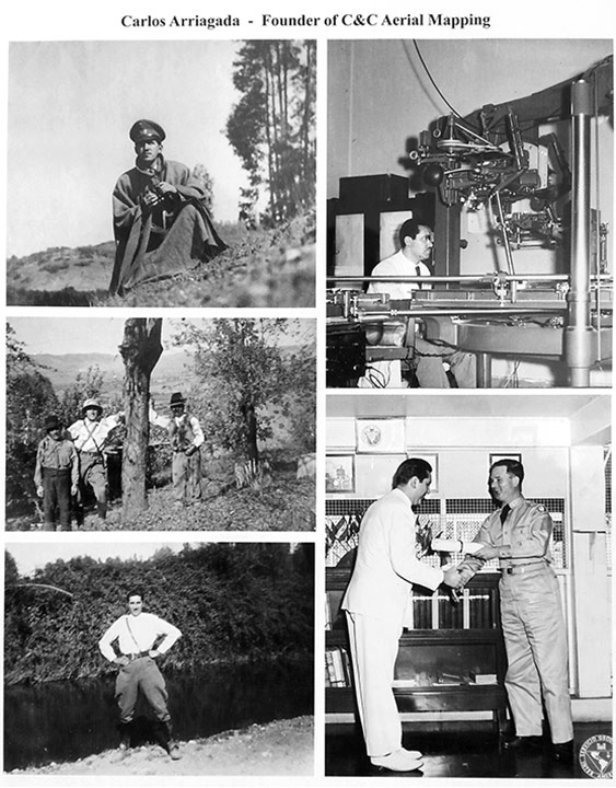
  1. 1951
    Carlos Arriagada begins his career in photogrammetry at the Chilean Geographic Military Institute — training at the Chilean and Panama Institutes of Geodetic Survey, and later teaching the discipline.
  2. 1962
    He immigrates to the United States to join Surdex Corporation in Missouri.
  3. 1977
    He founds C&C Aerial Mapping Services in San Dimas, California.
  4. 1994
    His daughter Beatriz Arriagada and grandson Robert Lafica incorporate Central Coast Aerial Mapping in San Luis Obispo.
  5. Today
    A third generation flies UAV LiDAR and builds 3D reality capture alongside the firm’s manned photogrammetry heritage.
Robert Lafica, President of Central Coast Aerial Mapping, in front of a large-format aerial map
Leadership

Robert Lafica, President

A third-generation photogrammetrist and ASPRS Certified Photogrammetrist (CP-1241), Robert leads CCAM’s mapping work with over 30 years of experience in the field. He has partnered with State, County, and City agencies — including the LA County Transportation Commission, Metro Rail, and Los Angeles International Airport — carrying the family’s accuracy discipline into modern UAV LiDAR and 3D capture.

Credentials

Certified, qualified, and standards-driven

CALTRANS qualified

Qualified by Caltrans for 3D digital mapping and remote sensing.

ASPRS & ACSM standards

Work complies with the mapping-accuracy standards of ASPRS and the American Congress on Surveying and Mapping.

Produced in house

Photogrammetric mapping, surface models, orthophotos, and 3D deliverables are produced in house at our San Luis Obispo facility.

Agency-grade experience

Project history with State, County, and City agencies across California.

Heritage meets modern

What we do today

The same accuracy discipline that built our reputation in manned photogrammetry now drives our newest pillars. We fly UAV LiDAR for dense bare-earth under vegetation, build 3D reality capture for digital-twin and design workflows, and deliver Civil 3D-ready surfaces engineers can design against — all from one team.

See all services →

Have a site that needs mapping?

Tell us the project and the goal — we’ll recommend the right capture and deliverable.

Get a quote